


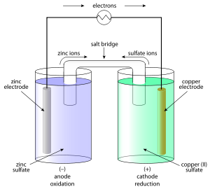
It is having a heavy-gauge copper outer vessel. Daniell cell...
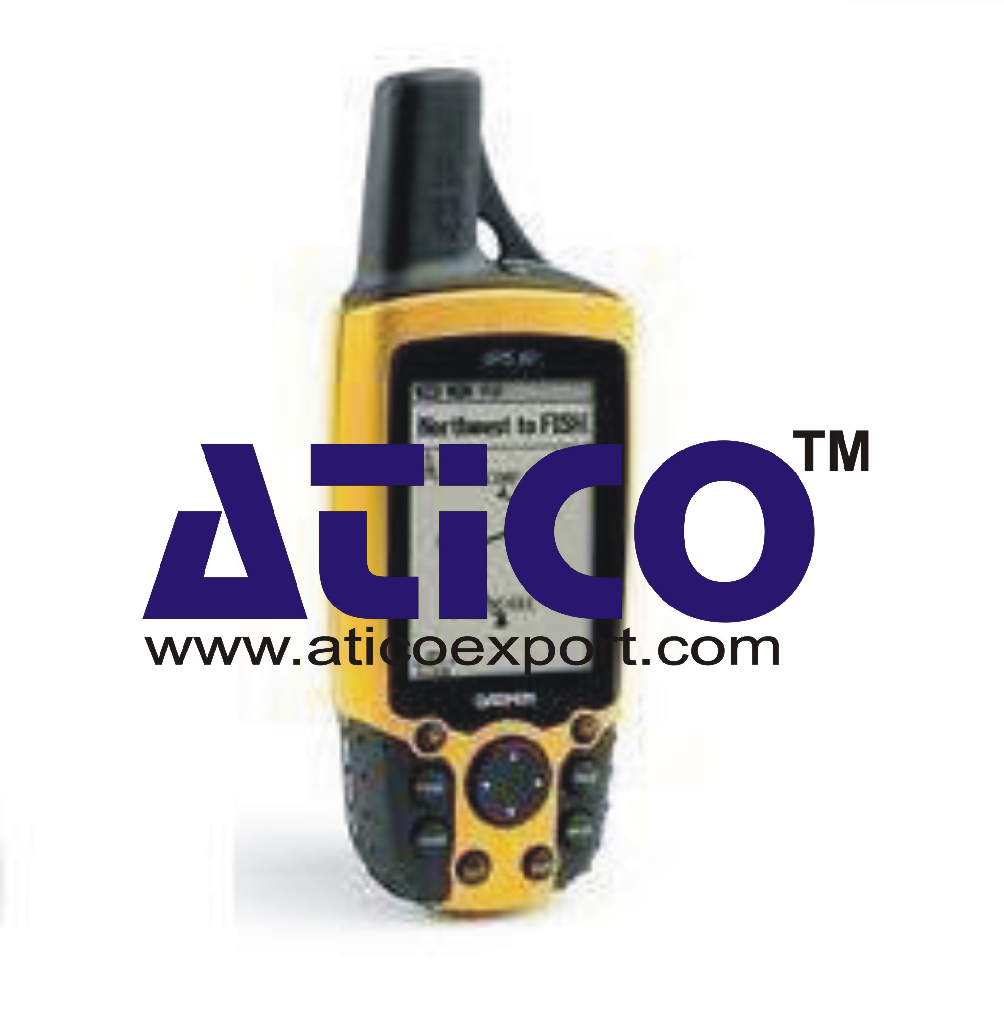
Handheld GPS Features Most popular Handheld GPS with 3 axis compass Worldwide base map 65K color, sunlight readable display Wireless capability to share waypoints, routes a...
| Physical dimension | 2.1” x 4.0” x 1.3” |
| Display size | 1.4” x 1.7” |
| Display resolution | 176 x 220 pixels |
| Display type | Transflective, 65-K color TFT |
| Weight | 5 oz (141.7 g ) with batteries |
| Battery life | 25 hours |
| Water rating | IPX7 |
| Floats | No |
| High sensitivity receiver | Yes |
| Interface | USB |
| Base map | Yes |
| Preloaded maps | No |
| Ability to add maps | Yes |
| Built in memory | 1.7 GB |
| Accepts data card | MicroSDTM card (not included) |
| Waypoints / favorites / locations | 2000 |
| Routes | 200 |
| Track log | 10,000 points, 200 saved tracks |
| Automatic routing | Yes ( with optional mapping for detailed roads ) |
| Electronic compass | Yes ( tilt-compensated 3-axis ) |
| Touch screen | No |
| Barometer altimeter | Yes |
| Camera | No |
| Geo caching friendly | Yes ( Paperless ) |
| Custom maps compatible | Yes |
| Hunt / fish calendar | Yes |
| Sun and Moon information | Yes |
| Area calculation | Yes |
| Custom POIs ( ability to add additional points of interest ) | Yes |
| Unit to unit transfer ( share data wirelessly with similar units ) | Yes |
| Picture viewer | Yes |
No Review Yet.
It is having a heavy-gauge copper outer vessel. Daniell cell...
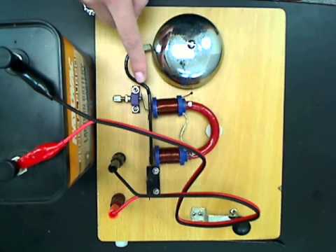
An electric bell is a mechanical bell that works by usi...
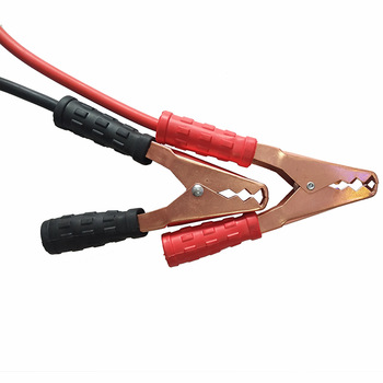
Alligator Battery Clips Wide jaws, toothed, strong spr...
Auto Transformer Continuously variable voltage transformer h...
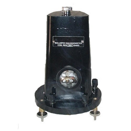
Ballistic Galvanometer is a type of sensitive galvanometer....
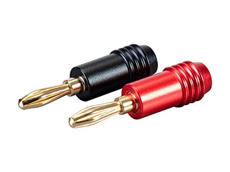
Banana Plug 4 mm pin, spring insert, screwed on plastic body...
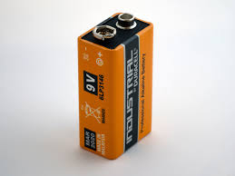
Battery 12 V, 34 Amphr, car type, each cell provided with ex...
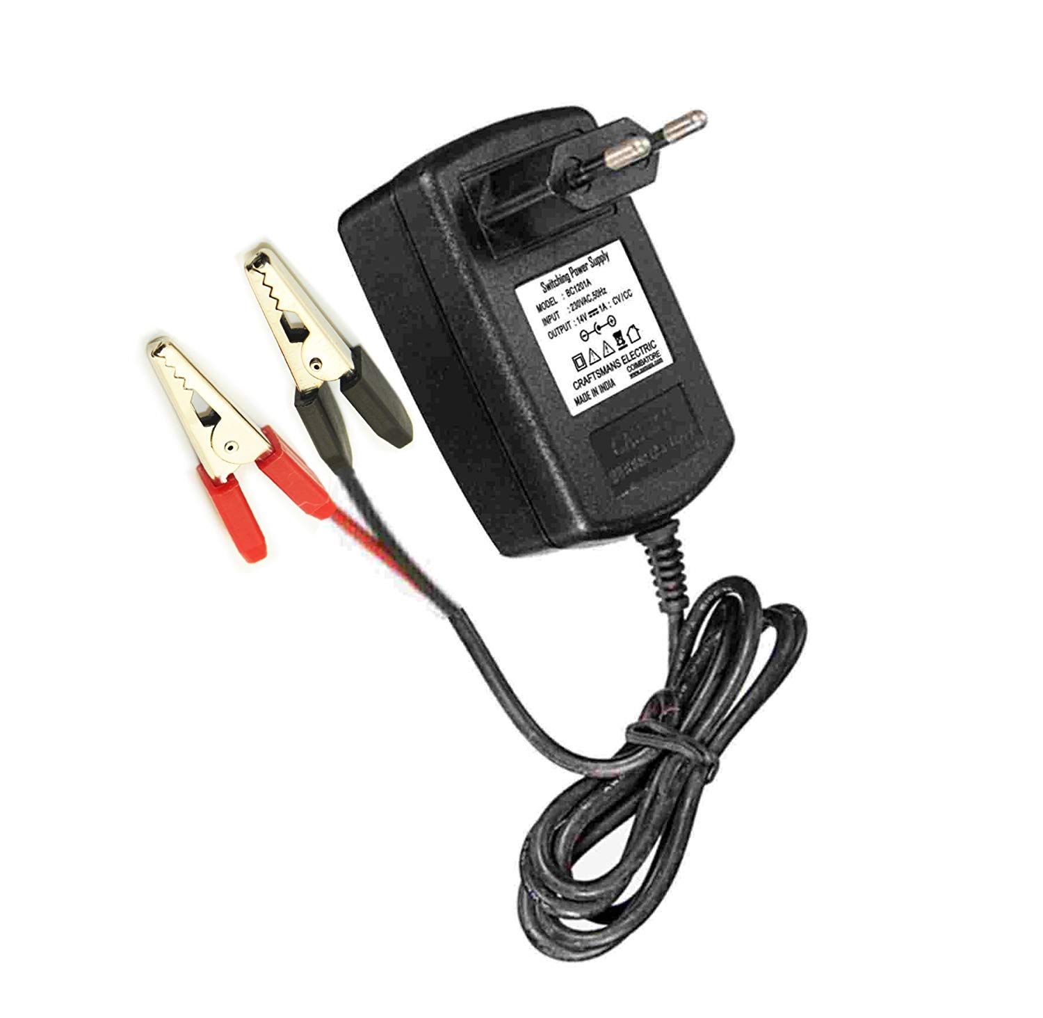
Battery Charger For charging batteries. In metallic case wit...
Copyrights © 2026 All Rights Reserved by Atico

Product
Reviews
add Review
reviews
No Review Yet.